Map and Map Editor #13
CUT
cutter bot commented just now
🎬 Cutter preview — PR #13
 Use map painting tools (Tree brush, Mountain, Lake brush, River, Eraser) — Painting tools let users draw trees, mountains, lakes, rivers, and erase scenery on the world map in real time. | 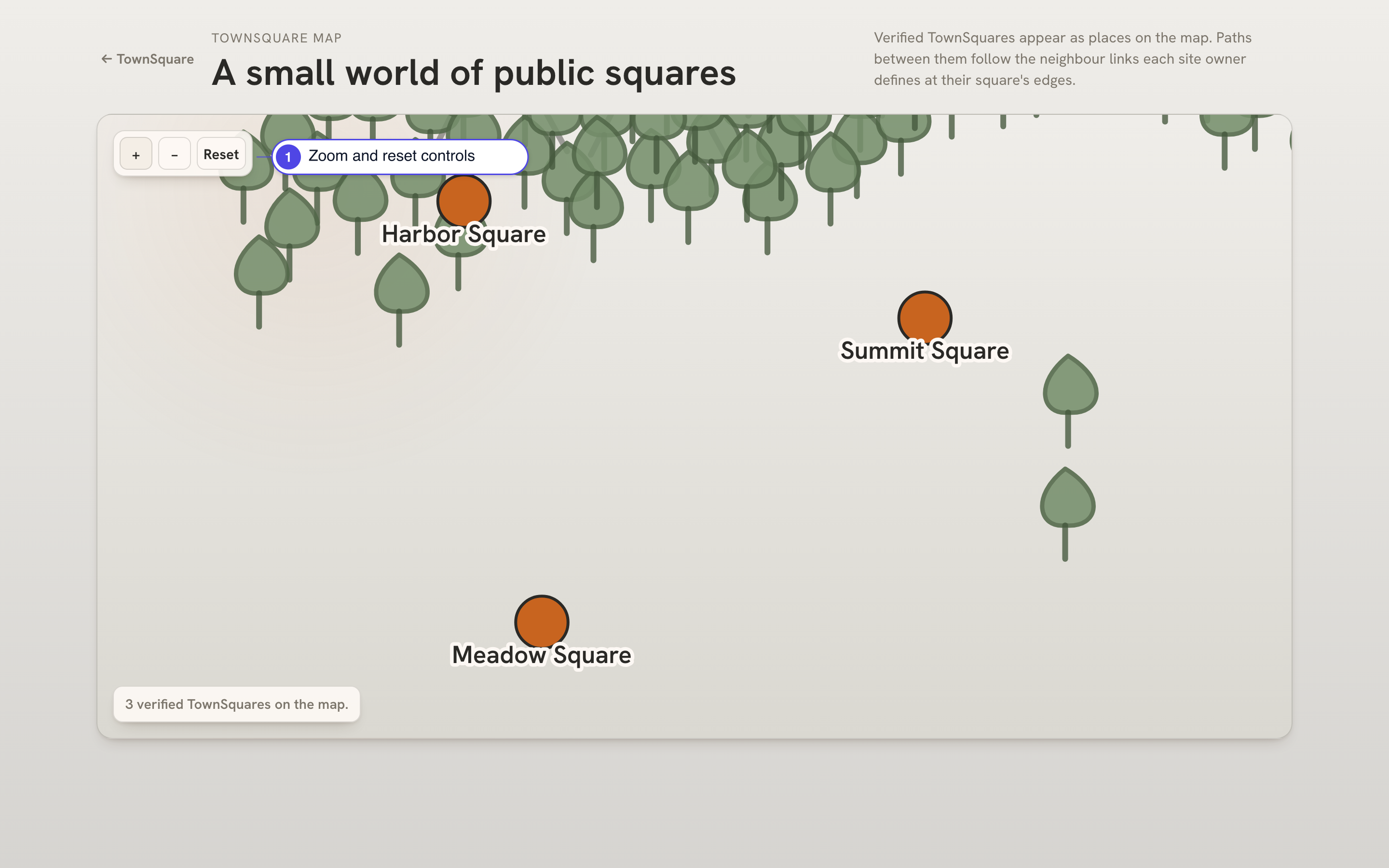 Zoom or reset the public map view — Zoom controls scale the public TownSquare map in and out. |
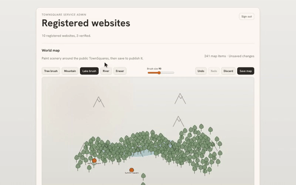
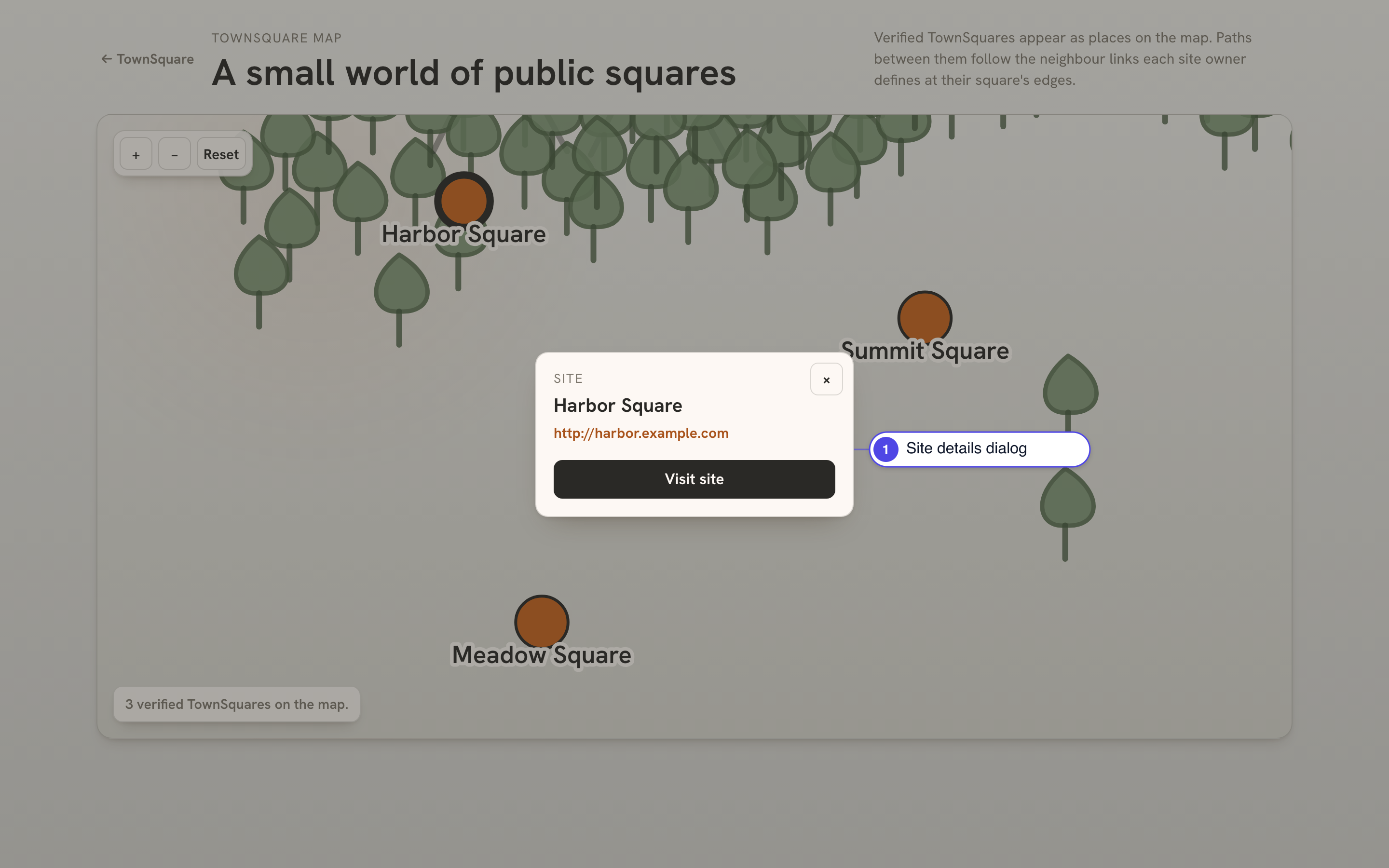 View TownSquare site details — Selecting a square opens a details dialog with its name, origin URL, and a Visit site button. | 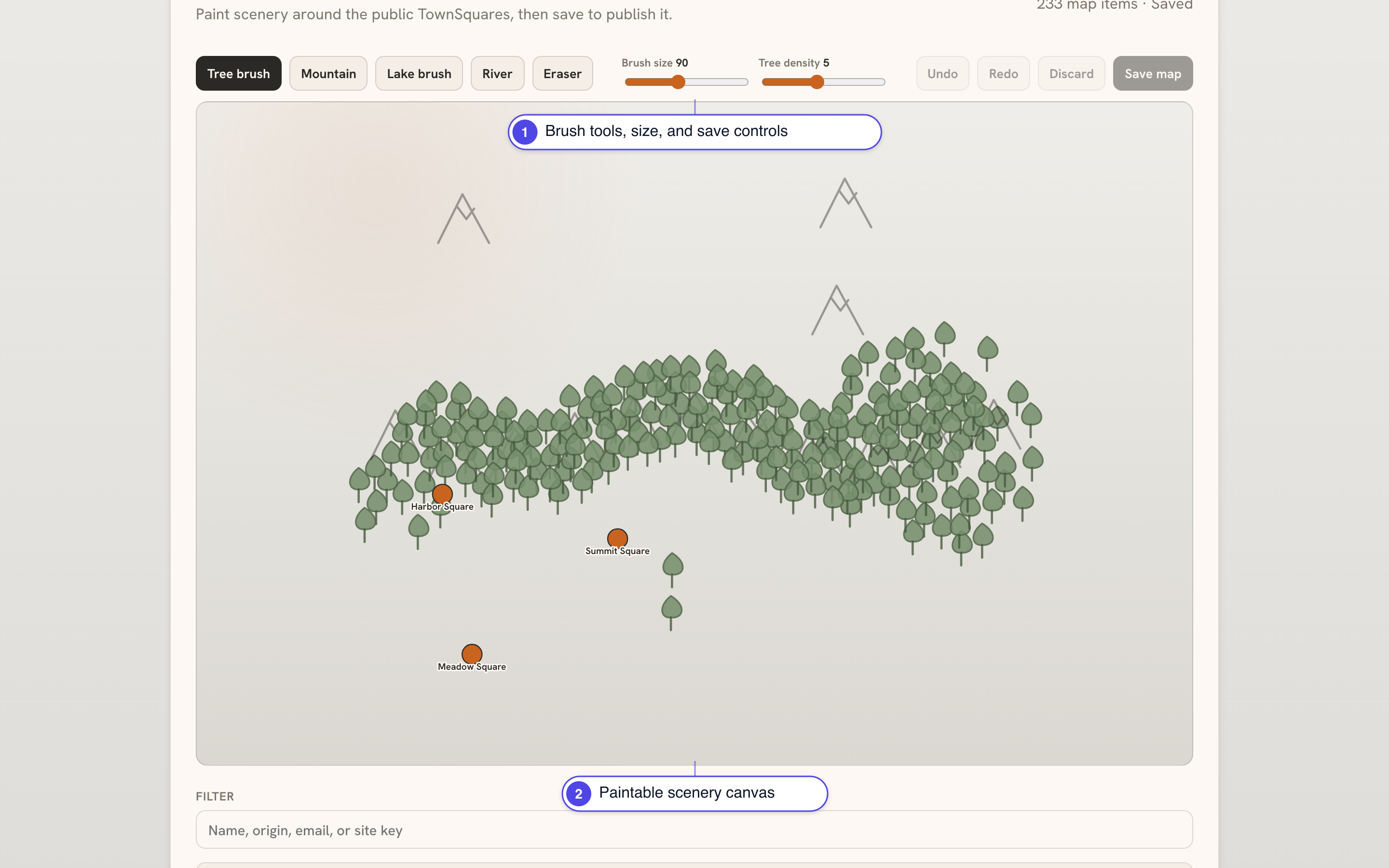 open service admin world map editor — World map editor lets admins paint trees, mountains, lakes, and rivers around TownSquares before saving. |
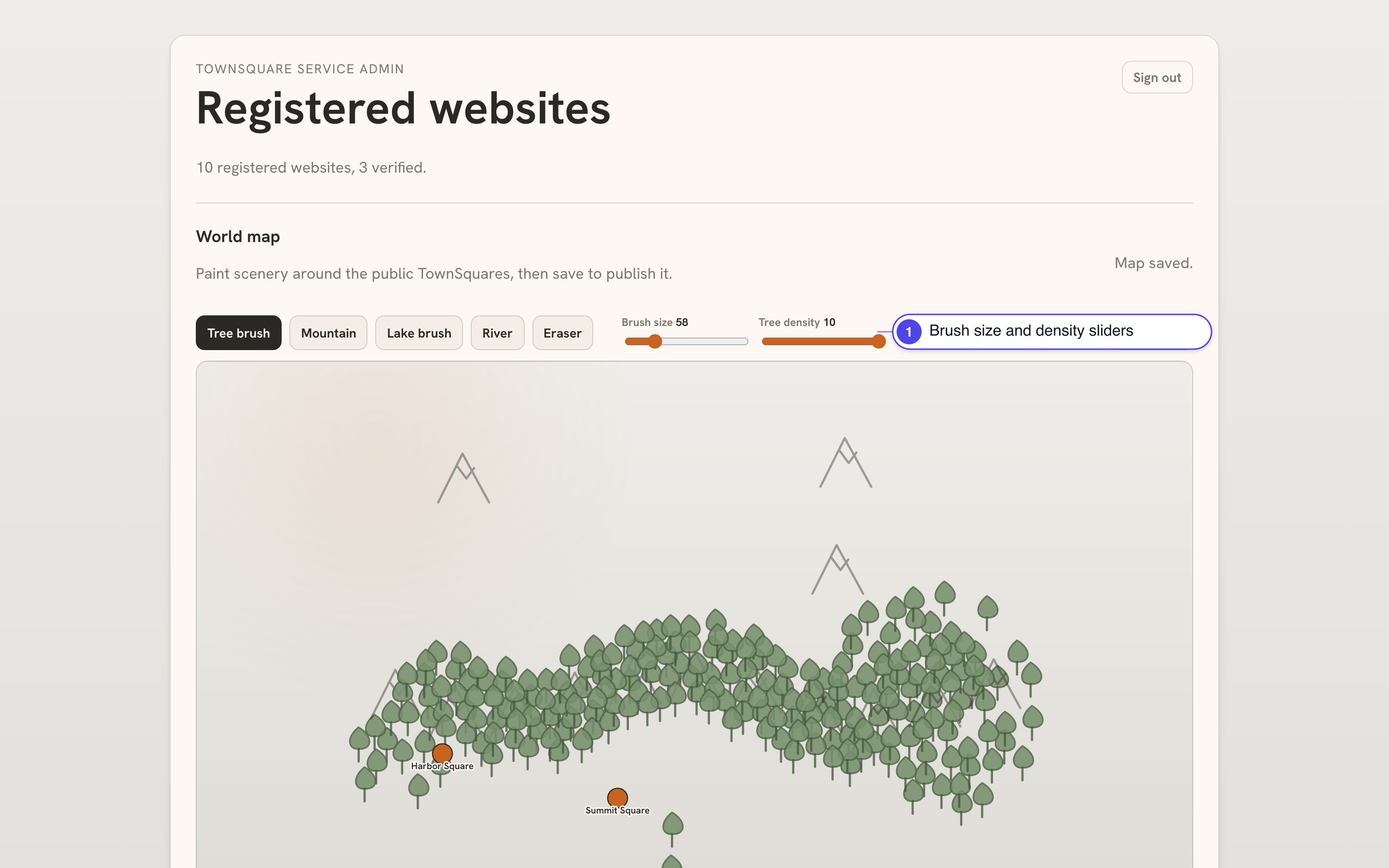 Adjust map brush size and tree density — Brush size and tree density sliders tune the tree brush, with live value readouts. | 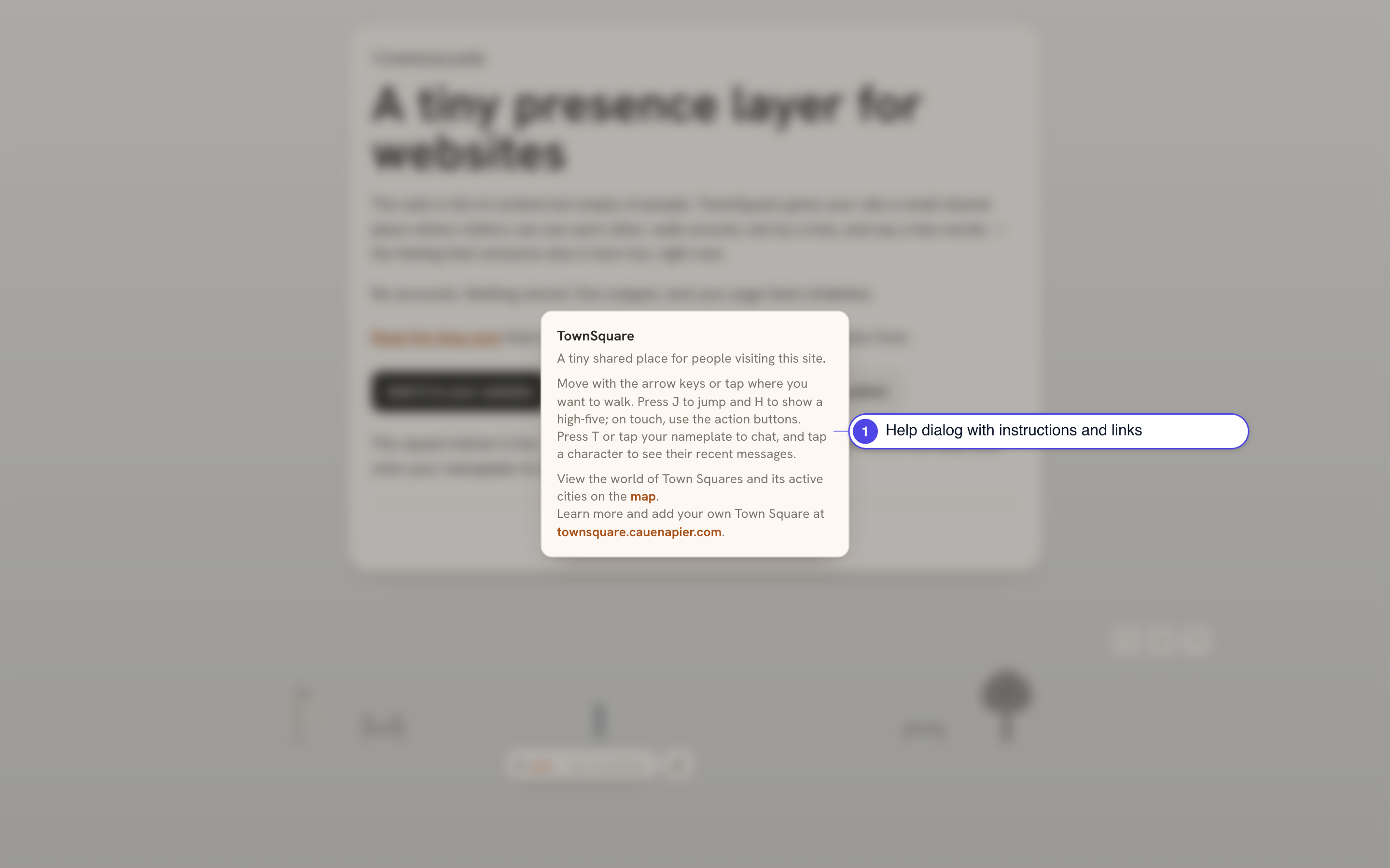 Toggle widget help panel — Help dialog explains TownSquare with controls guide and links to the map and homepage. |
Summary
Adds the global TownSquare map and a visual map editor for service admins.
Changes
DATA_DIRTesting
npm run check